

Naphill Common - Maps
Naphill Common is approximately 1mile x ¾ mile x ¾ mile and 155.4 acres, 62.9 hectares (SSSI 175.7 acres, 71.1 hectares.) (1 hectare = 2.471 acres) in area.
Naphill Common - Ownership Map 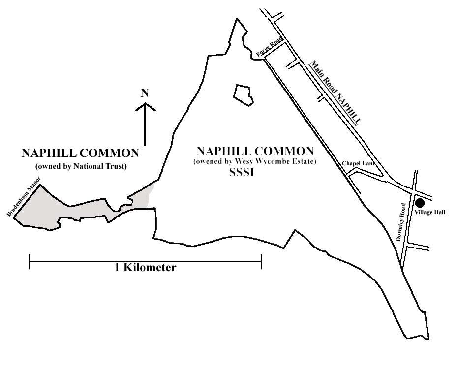
Naphill Common 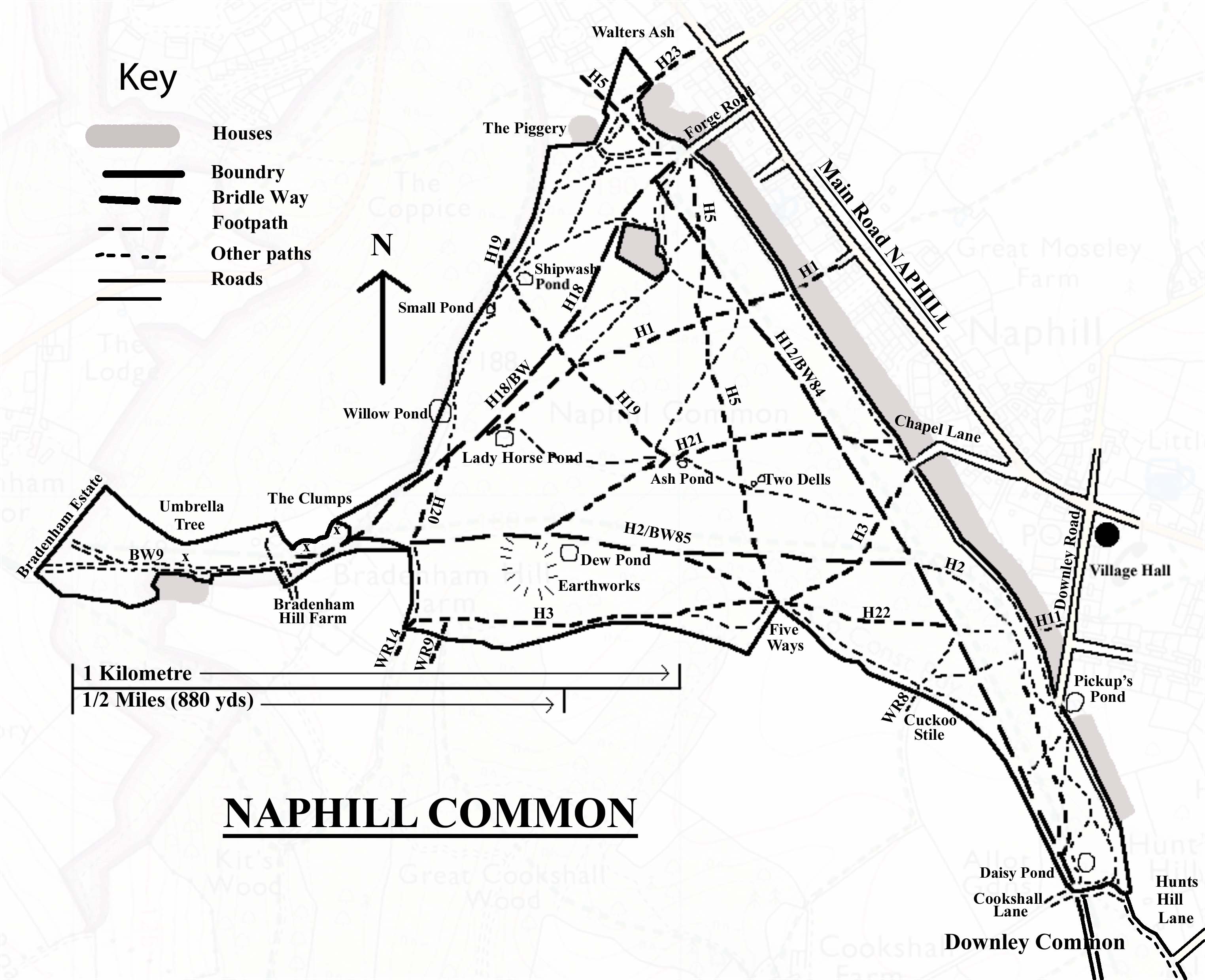
Based on the Bridleways, Footpaths and other maps.
See also streetmap
Click HERE to download this map for printing
Naphill Common 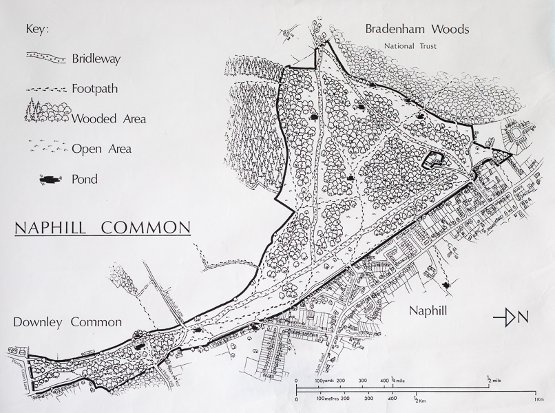
Drawing by Philip Hussey.
Naphill Common - Aerial View 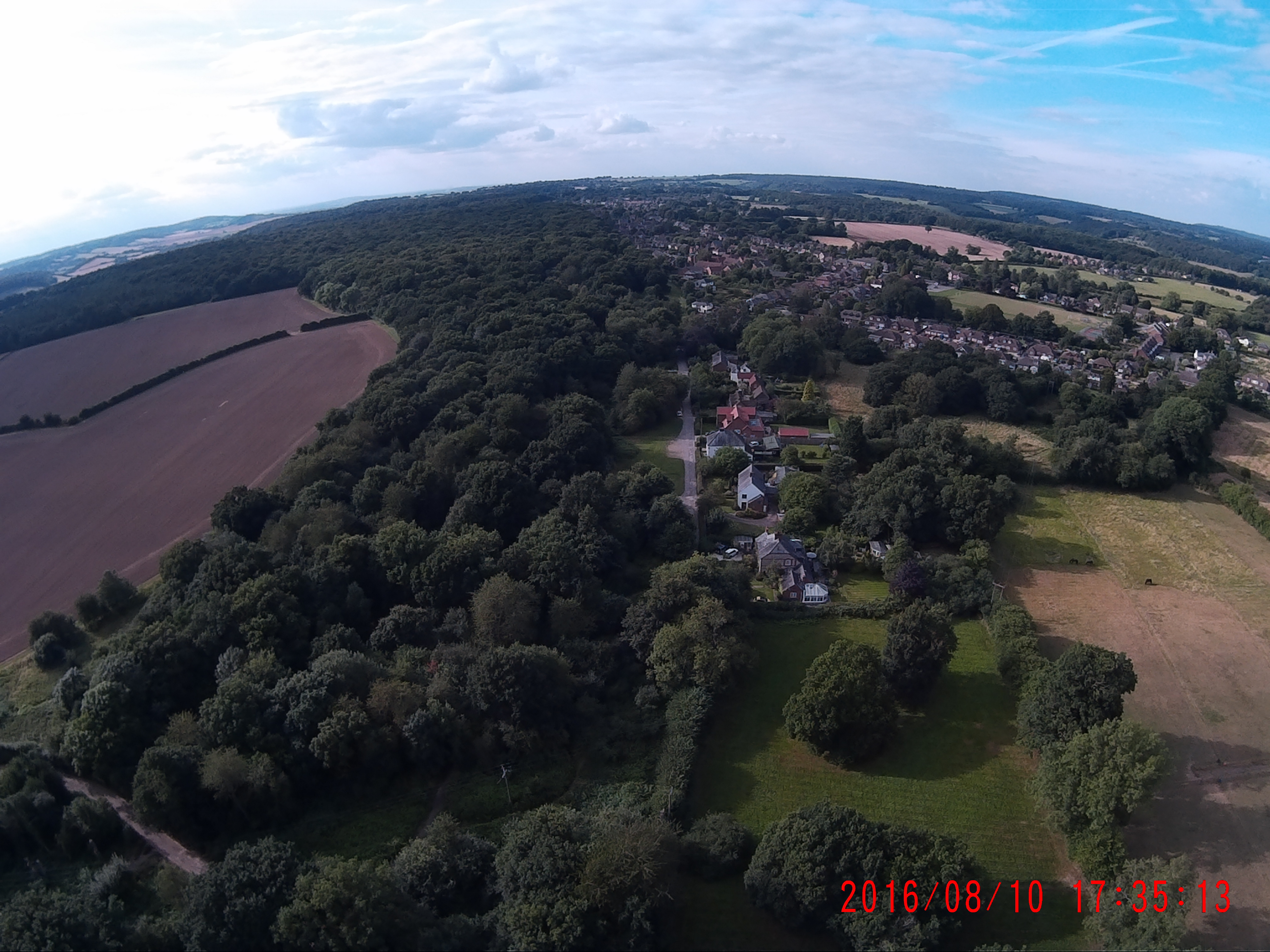
Naphill Common looking north with Cookshall Lane bottom left and Downley Road in the centre
Tithe map 1847 showing part of Naphill Common 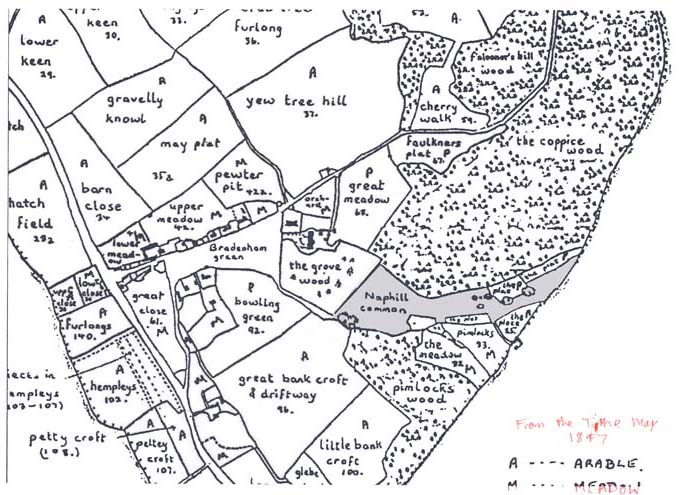
Naphill Common drawn from memory by Mr. Wilfrid G. Smith
1948 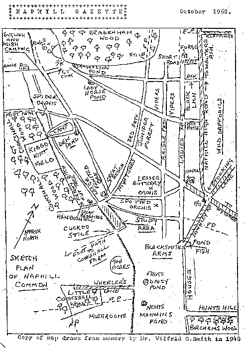
1825 Bryant Map Naphill Common (Bucks Archaeological Society) 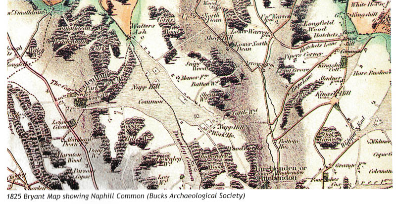
Map Naphill Common unknown date 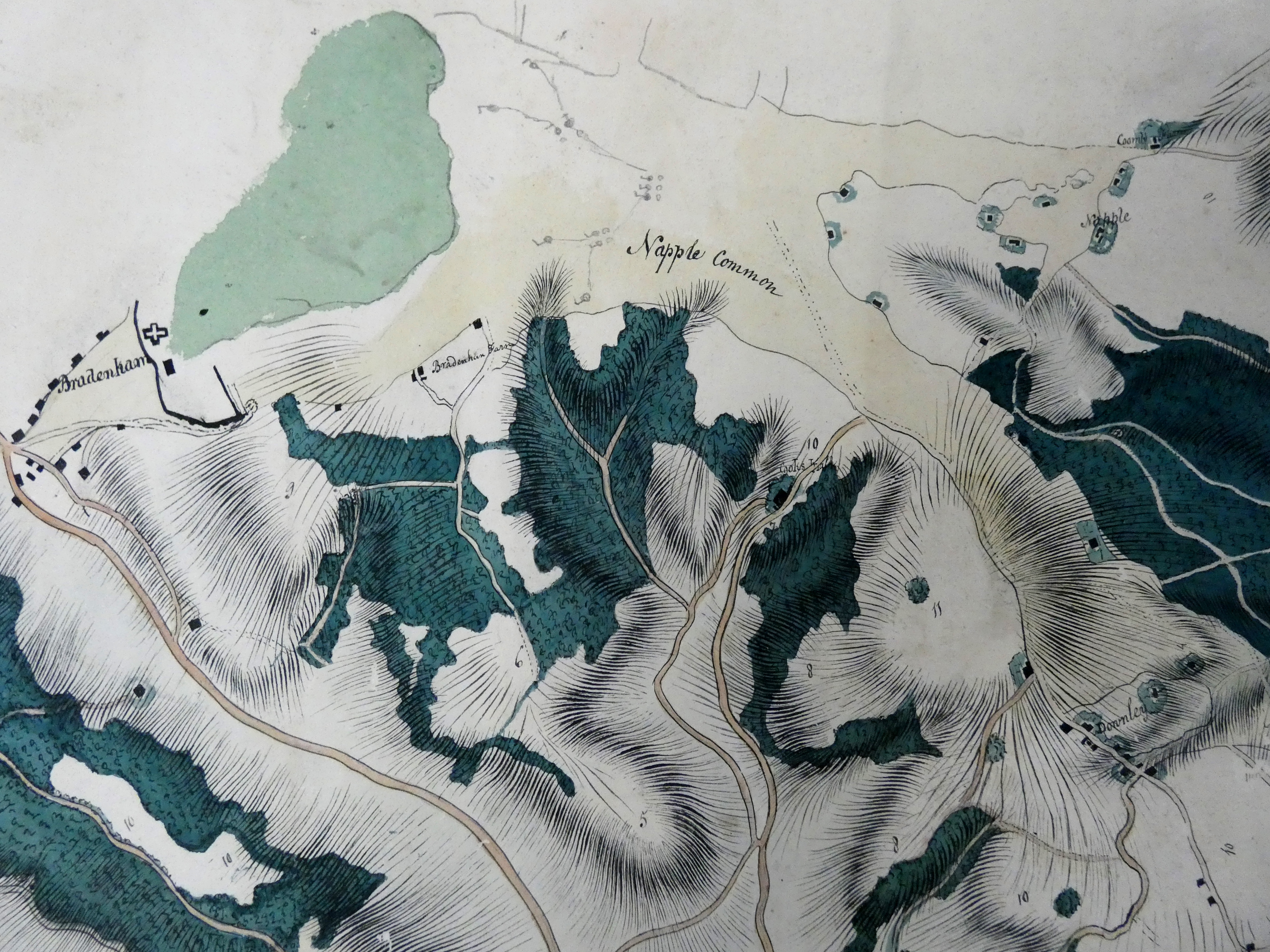
"This is a photo of part of a map of unknown date and origin held amongst papers of the Colonial Service at the National Archives (reference MPGG1/39/4).
The map shows Naphill and the Common (spelt Napple). Coombe, Cookshall and Bradenham Farms are all named on the map, and we can see several buildings on what is now Hunts Hill Lane, and to the west. This extract also shows Downley and Bradenham. There is no key with this map so we cannot tell what the numbers represent and the circular markings on the Common itself are a mystery. It seems likely that the map was created by Officers of the Royal Military College, which had been established in 1799 at the Antelope Inn in High Wycombe's High Street (not the current Antelope in Church Square). Their training included trigonometry, surveying and map-making, so the map is likely to be an accurate representation. The College moved away from Wycombe in 1813 to Farnham, Surrey and eventually to Sandhurst, so the probable date of the map is around 1800."
Naphill Common - Woodland 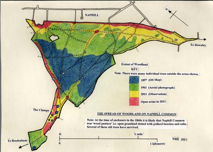
Old Maps
All maps and photographs are subject to copyright and should only be used for research
In most cases North is to the top of your screen
Aerial photographs
Aerial Photograph of Naphill Common 1947
Aerial Photograph of Brome and Wade 1979
Aerial Photograph of Naphill Common (184) 1989
Aerial Photograph of Naphill Common (185) 1989
Aerial Photograph of Naphill Common (3030) 1947
Aerial Photograph of Naphill Common (3031) 1947
Aerial Photograph of Walters Ash (4040)1946
Aerial Photograph of Walters Ash (4041) 1946
Aerial Photograph of West Wycombe (2339) 1985
Aerial Photograph of West Wycombe (2340) 1985
Maps
Map of Naphill Common OS 1822-1835
Map of Naphill Common OS 1879-1886
Map of Naphill Common OS 1927
Map of Naphill Common OS 2004
Map of Naphill Enclosure 1859
1862 Part Inclosure Map of Naphill
1862 Part Inclosure Map of Naphill
1862 Part Inclosure Map of Naphill
1862 Part Inclosure Map of Naphill
1862 Part Inclosure Map of Naphill
1862 Part Inclosure Map of Naphill
1862 Part Inclosure Map of Naphill
1862 Part Inclosure Map of Naphill
1862 Part Inclosure Map of Naphill
1862 Part Inclosure Map of Naphill
1862 Part Inclosure Map of Naphill
1859 Part Inclosure Map of Hughenden
1859 Part Inclosure Map of Hughenden
1859 Part Inclosure Map of Hughenden
1859 Part Inclosure Map of Hughenden
1859 Part Inclosure Map of Hughenden
1859 Part Inclosure Map of Hughenden
1859 Part Inclosure Map of Hughenden
1859 Part Inclosure Map of Hughenden
1859 Part Inclosure Map of Hughenden
1859 Part Inclosure Map of Hughenden
1859 Part Inclosure Map of Hughenden
1859 Part Inclosure Map of Hughenden
1859 Part Inclosure Map of Hughenden
1859 Part Inclosure Map of Hughenden
1859 Part Inclosure Map of Hughenden
1859 Part Inclosure Map of Hughenden
1859 Part Inclosure Map of Hughenden
1859 Part Inclosure Map of Hughenden
1859 Part Inclosure Map of Hughenden
1859 Part Inclosure Map of Hughenden
1859 Part Inclosure Map of Hughenden
1859 Part Inclosure Map of Hughenden
1859 Part Inclosure Map of Hughenden
1859 Part Inclosure Map of Hughenden
1859 Part Inclosure Map of Hughenden
1859 Part Inclosure Map of Hughenden
1859 Part Inclosure Map of Hughenden
1859 Part Inclosure Map of Hughenden
1859 Part Inclosure Map of Hughenden
We are always keen to see any old maps of Naphill Common. If you have one please contact Peter Davis.